Intelligent Urban Policymaking
ExpeditionHacks Grand Prize, AIGrant Finalist
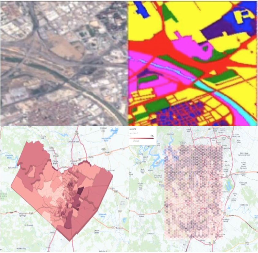
Satellite images contain valuable information about city processes such as urban sprawl. This project fit a deep vision model to classify parts of cities into urban classes. The model was then used to measure urbanization over time. By pairing this index with social and economic census data, the end product, a visualization tool for policymakers, aims to identify "strained" counties, areas that are growing in population without the proper resources to support them.